 vesseltracker.com
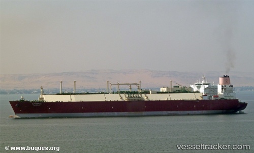
Al Khattiya
Current StatusWhere is the vessel?
Al Khattiya is currently in 15 nm W of HNB SEZ/Mumbai, based on AIS data received less than 1h ago.
Latest AIS update:
Current position: 19.05548° N, 72.56153° E (15 nm W of HNB SEZ/Mumbai)
Average speed (last 7 days): Loading…
Average speed (last 30 days): Loading…
Vessel profile: Al Khattiya is a Lng Tanker with dimensions 50m x 315m.
This page combines live AIS, route history, probable destination signals, nearby traffic, and port activity for practical vessel monitoring.
The current position of vessel Al Khattiya is 19.05548 lat / 72.56153 lng. Updated: 2026-05-14 08:09:40 UTCNearest reference points:
- Near HNB SEZ/Mumbai
- Near Mumbai
- Near NHAVA SHEVA
Details:
Live Vessel Al Khattiya Analytics (details, animations, etc.)
Recent AIS points (UTC):
2026-05-14 04:45:34 UTC · 19.05865, 72.56235 · SOG 0 kn · COG 241°2026-05-14 06:00:45 UTC · 19.05764, 72.56258 · SOG 0.2 kn · COG 265°
2026-05-14 07:54:49 UTC · 19.05562, 72.56173 · SOG 0 kn · COG 321°
2026-05-14 08:09:40 UTC · 19.05548, 72.56153 · SOG 0.1 kn · COG 325°