 vesseltracker.com
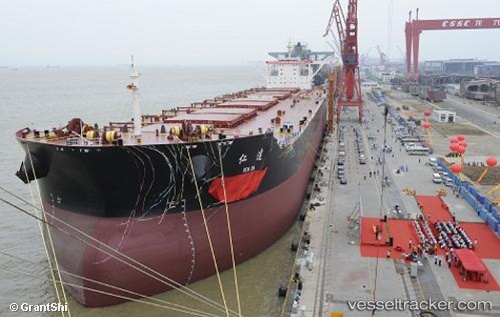
Ren Da
Current StatusWhere is the vessel?
Ren Da is currently in 234 nm E of Dam Mon, based on AIS data received about 2h ago.
Latest AIS update:
Current position: 11.46667° N, 113.18333° E (234 nm E of Dam Mon)
Average speed (last 7 days): Loading…
Average speed (last 30 days): Loading…
Vessel profile: Ren Da is a Ore Carrier with dimensions 52m x 325m.
This page combines live AIS, route history, probable destination signals, nearby traffic, and port activity for practical vessel monitoring.
The current position of vessel Ren Da is 11.46667 lat / 113.18333 lng. Updated: 2026-05-16 10:05:56 UTCNearest reference points:
- 226 nm SE of Tan Cang Qui Nhon
- 211 nm N of Pulau Lang Lang
- 220 nm N of Pulau Lang Lang
Details:
Live Vessel Ren Da Analytics (details, animations, etc.)
Recent AIS points (UTC):
2026-05-16 07:35:54 UTC · 11.12500, 112.92333 · SOG 10 kn · COG -1°2026-05-16 07:35:54 UTC · 11.12500, 112.92333 · SOG 10 kn · COG -1°
2026-05-16 10:05:56 UTC · 11.46667, 113.18333 · SOG 10 kn · COG -1°
2026-05-16 10:05:56 UTC · 11.46667, 113.18333 · SOG 10 kn · COG -1°