 vesseltracker.com
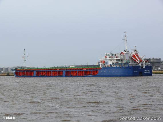
 KARELIS 72
Current Status
Where is the vessel?
KARELIS 72 is currently in 71 nm S of Ordzhonikidze, based on AIS data received about 2h ago.
Latest AIS update:
Current position: 43.74607° N, 35.72187° E (71 nm S of Ordzhonikidze)
Average speed (last 7 days): Loading…
Average speed (last 30 days): Loading…
Vessel profile: KARELIS 72 is a General Cargo Ship with dimensions 108m x 16m.
This page combines live AIS, route history, probable destination signals, nearby traffic, and port activity for practical vessel monitoring.
The current position of vessel KARELIS 72 is 43.74607 lat / 35.72187 lng. Updated: 2026-05-13 21:58:39 UTCNearest reference points:
- 79 nm SE of Yalta
- 76 nm N of Sinop
- 54 nm NE of Sinop
Currently sailing under the flag of St.Kitts and Nevis ![]()
KARELIS 72 built in 2008 year
Deadweight:
5466 tDetails:
Live Vessel KARELIS 72 Analytics (details, animations, etc.)
Recent AIS points (UTC):
2026-05-13 20:16:50 UTC · 43.57612, 35.39564 · SOG 10.2 kn · COG 53°2026-05-13 21:25:00 UTC · 43.68819, 35.61381 · SOG 10.4 kn · COG 57°
2026-05-13 21:58:39 UTC · 43.74607, 35.72187 · SOG 10.4 kn · COG 48°
2026-05-13 21:58:39 UTC · 43.74607, 35.72187 · SOG 10.4 kn · COG 48°