 vesseltracker.com
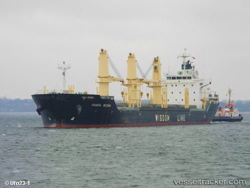
 ROXETTE
Current Status
Where is the vessel?
ROXETTE is currently in 21 nm E of Villafranca Tirrena, based on AIS data received less than 1h ago.
Latest AIS update:
Current position: 36.30500° N, 15.87500° E (21 nm E of Villafranca Tirrena)
Average speed (last 7 days): Loading…
Average speed (last 30 days): Loading…
Vessel profile: ROXETTE is a Bulk Carrier with dimensions m x m.
This page combines live AIS, route history, probable destination signals, nearby traffic, and port activity for practical vessel monitoring.
The current position of vessel ROXETTE is 36.30500 lat / 15.87500 lng. Updated: 2026-05-14 11:35:00 UTCNearest reference points:
- 34 nm NE of Villafranca Tirrena
- 24 nm S of Licodia Eubea
- 33 nm N of Ryuo
Currently sailing under the flag of Barbados ![]()
Details:
Live Vessel ROXETTE Analytics (details, animations, etc.)
Recent AIS points (UTC):
2026-05-14 08:20:01 UTC · 36.30833, 16.51333 · SOG 9 kn · COG -1°2026-05-14 10:08:18 UTC · 36.30877, 16.15754 · SOG 9.3 kn · COG 268°
2026-05-14 10:38:49 UTC · 36.30731, 16.05845 · SOG 9.5 kn · COG 264°
2026-05-14 11:35:00 UTC · 36.30500, 15.87500 · SOG 9 kn · COG -1°