 vesseltracker.com
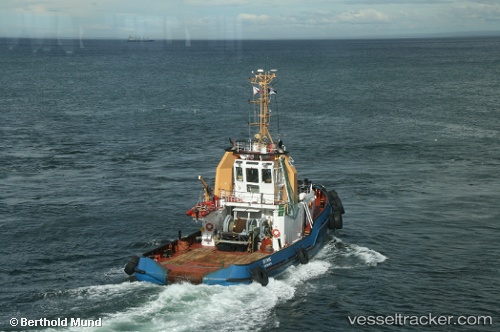
Skyring
Current StatusWhere is the vessel?
Skyring is currently in Near Iquique, based on AIS data received about 1h ago.
Latest AIS update:
Current position: 20.20333° S, 70.15167° W (Near Iquique)
Average speed (last 7 days): Loading…
Average speed (last 30 days): Loading…
Vessel profile: Skyring is a Tug with dimensions 9m x 35m.
This page combines live AIS, route history, probable destination signals, nearby traffic, and port activity for practical vessel monitoring.
The current position of vessel Skyring is -20.20333 lat / -70.15167 lng. Updated: 2026-05-16 11:26:45 UTCNearest reference points:
- Near Arica
Details:
Live Vessel Skyring Analytics (details, animations, etc.)
Recent AIS points (UTC):
2026-05-16 08:04:08 UTC · -20.20327, -70.15232 · SOG 0 kn · COG 88°2026-05-16 10:13:10 UTC · -20.20332, -70.15215 · SOG 0 kn · COG 344°
2026-05-16 10:25:11 UTC · -20.20333, -70.15211 · SOG 0.1 kn · COG 335°
2026-05-16 11:26:45 UTC · -20.20333, -70.15167 · SOG 0 kn · COG -1°