 vesseltracker.com
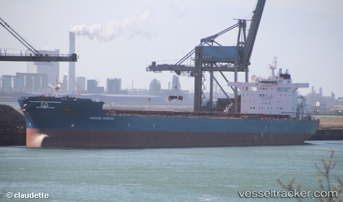
Anangel Guardian
Current StatusWhere is the vessel?
Anangel Guardian is currently in 128 nm NE of Amurang, based on AIS data received less than 1h ago.
Latest AIS update:
Current position: 2.99665° N, 123.46133° W (128 nm NE of Amurang)
Average speed (last 7 days): Loading…
Average speed (last 30 days): Loading…
Vessel profile: Anangel Guardian is a Bulk Carrier with dimensions 46m x 292m.
This page combines live AIS, route history, probable destination signals, nearby traffic, and port activity for practical vessel monitoring.
The current position of vessel Anangel Guardian is 2.99665 lat / -123.46133 lng. Updated: 2026-04-26 07:14:29 UTCDetails:
Live Vessel Anangel Guardian Analytics (details, animations, etc.)
Recent AIS points (UTC):
2026-04-26 03:32:09 UTC · 2.77195, -122.86318 · SOG 10.2 kn · COG 285°2026-04-26 04:07:42 UTC · 2.80667, -122.95667 · SOG 10 kn · COG -1°
2026-04-26 06:00:46 UTC · 2.91913, -123.26110 · SOG 10.5 kn · COG 286°
2026-04-26 07:14:29 UTC · 2.99665, -123.46133 · SOG 10.1 kn · COG 288°