 vesseltracker.com
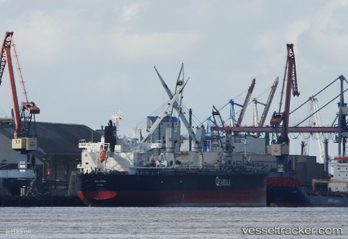
 KIWI ARROW
Current Status
Where is the vessel?
KIWI ARROW is currently in 11 nm S of Fairton, based on AIS data received less than 1h ago.
Latest AIS update:
Current position: 39.19675° N, 75.28112° W (11 nm S of Fairton)
Average speed (last 7 days): Loading…
Average speed (last 30 days): Loading…
Vessel profile: KIWI ARROW is a General Cargo with dimensions m x m.
This page combines live AIS, route history, probable destination signals, nearby traffic, and port activity for practical vessel monitoring.
The current position of vessel KIWI ARROW is 39.19675 lat / -75.28112 lng. Updated: 2026-05-16 10:26:15 UTCNearest reference points:
- Near Slaughter Beach
- Near Corbin City
- Near Wilmington
Currently sailing under the flag of Bahamas ![]()
Details:
Live Vessel KIWI ARROW Analytics (details, animations, etc.)
Recent AIS points (UTC):
2026-05-16 07:40:16 UTC · 38.75503, -74.96847 · SOG 4.1 kn · COG 306°2026-05-16 08:05:45 UTC · 38.77835, -75.02417 · SOG 8.9 kn · COG 292°
2026-05-16 10:15:26 UTC · 39.16352, -75.25588 · SOG 12.8 kn · COG 324°
2026-05-16 10:26:15 UTC · 39.19675, -75.28112 · SOG 13 kn · COG 336°