 vesseltracker.com
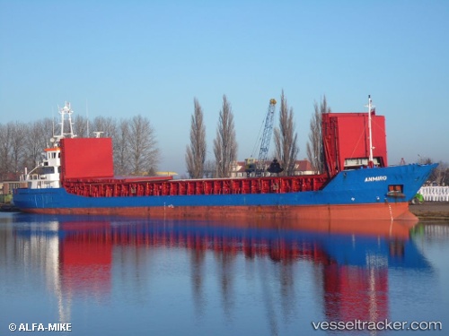
 Anmiro
Current Status
Where is the vessel?
Anmiro is currently in Near Grangetown, based on AIS data received less than 1h ago.
Latest AIS update:
Current position: 54.59641° N, 1.17277° W (Near Grangetown)
Average speed (last 7 days): Loading…
Average speed (last 30 days): Loading…
Vessel profile: Anmiro is a Multi Purpose Carrier with dimensions 88m x 89m.
This page combines live AIS, route history, probable destination signals, nearby traffic, and port activity for practical vessel monitoring.
The current position of vessel Anmiro is 54.59641 lat / -1.17277 lng. Updated: 2026-04-21 11:55:03 UTCNearest reference points:
- Near TYNE
- Near Blyth
- Near Hessle/Hull
Currently sailing under the flag of Antigua Barbuda ![]()
Anmiro built in 2009 year
Deadweight:
3694 tDetails:
Live Vessel Anmiro Analytics (details, animations, etc.)
Recent AIS points (UTC):
2026-04-21 07:56:20 UTC · 54.59642, -1.17277 · SOG 0 kn · COG 42°2026-04-21 09:57:04 UTC · 54.59642, -1.17278 · SOG 0 kn · COG 42°
2026-04-21 10:26:20 UTC · 54.59640, -1.17277 · SOG 0 kn · COG 41°
2026-04-21 11:55:03 UTC · 54.59641, -1.17277 · SOG 0 kn · COG 41°