 vesseltracker.com
 Erik
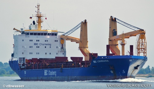
Erik
Current Status
Where is the vessel?
Erik is currently in 22 nm SW of Raigad, based on AIS data received about 1h ago.
Latest AIS update:
Current position: 18.47957° N, 72.52201° E (22 nm SW of Raigad)
Average speed (last 7 days): Loading…
Average speed (last 30 days): Loading…
Vessel profile: Erik is a Heavy Load Carrier with dimensions 138m x 21m.
This page combines live AIS, route history, probable destination signals, nearby traffic, and port activity for practical vessel monitoring.
The current position of vessel Erik is 18.47957 lat / 72.52201 lng. Updated: 2026-04-03 05:23:41 UTCNearest reference points:
- Near Mumbai
- Near HNB SEZ/Mumbai
- Near NHAVA SHEVA
Currently sailing under the flag of Antigua Barbuda ![]()
Erik built in 2008 year
Deadweight:
12763 tDetails:
Live Vessel Erik Analytics (details, animations, etc.)
Recent AIS points (UTC):
2026-04-02 23:55:32 UTC · 17.24679, 72.83814 · SOG 13.8 kn · COG 355°2026-04-03 01:46:23 UTC · 17.65097, 72.69056 · SOG 14 kn · COG 345°
2026-04-03 04:20:48 UTC · 18.24280, 72.55558 · SOG 13.6 kn · COG -1°
2026-04-03 05:23:41 UTC · 18.47957, 72.52201 · SOG 13.8 kn · COG 347°