 vesseltracker.com
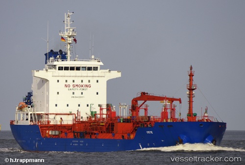
 Camden
Current Status
Where is the vessel?
Camden is currently in 325 nm N of ANEGADA, based on AIS data received less than 1h ago.
Latest AIS update:
Current position: 24.13348° N, 64.08806° W (325 nm N of ANEGADA)
Average speed (last 7 days): Loading…
Average speed (last 30 days): Loading…
Vessel profile: Camden is a Chemical Oil Products Tanker with dimensions 128m x 20m.
This page combines live AIS, route history, probable destination signals, nearby traffic, and port activity for practical vessel monitoring.
The current position of vessel Camden is 24.13348 lat / -64.08806 lng. Updated: 2026-05-14 17:19:19 UTCNearest reference points:
- 361 nm W of Villa Elisa
- Open sea, approx. 429 nm off the nearest listed port
- Open sea, approx. 426 nm off the nearest listed port
Currently sailing under the flag of Marshall Is ![]()
Camden built in 2008 year
Deadweight:
13075 tDetails:
Live Vessel Camden Analytics (details, animations, etc.)
Recent AIS points (UTC):
2026-05-14 13:36:59 UTC · 23.38909, -64.06313 · SOG 12 kn · COG 358°2026-05-14 15:40:01 UTC · 23.80463, -64.08009 · SOG 12.1 kn · COG 357°
2026-05-14 16:20:11 UTC · 23.93960, -64.08294 · SOG 12 kn · COG 357°
2026-05-14 17:19:19 UTC · 24.13348, -64.08806 · SOG 11.4 kn · COG 355°