 vesseltracker.com
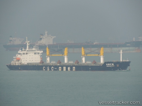
 Chang Hang Hui Hai
Current Status
Where is the vessel?
Chang Hang Hui Hai is currently in Near Shitoubu Pt, based on AIS data received about 1h ago.
Latest AIS update:
Current position: 21.48120° N, 109.55162° E (Near Shitoubu Pt)
Average speed (last 7 days): Loading…
Average speed (last 30 days): Loading…
Vessel profile: Chang Hang Hui Hai is a Bulk Carrier with dimensions 200m x 200m.
This page combines live AIS, route history, probable destination signals, nearby traffic, and port activity for practical vessel monitoring.
The current position of vessel Chang Hang Hui Hai is 21.48120 lat / 109.55162 lng. Updated: 2026-05-15 06:11:18 UTCNearest reference points:
- Near Beihai Pt
- Near Hepu
- Near Beihai
Currently sailing under the flag of China ![]()
Chang Hang Hui Hai built in 2010 year
Deadweight:
57300 tDetails:
Live Vessel Chang Hang Hui Hai Analytics (details, animations, etc.)
Recent AIS points (UTC):
2026-05-14 23:41:12 UTC · 21.48117, 109.55159 · SOG 0 kn · COG 22°2026-05-15 04:20:15 UTC · 21.48120, 109.55164 · SOG 0 kn · COG 22°
2026-05-15 04:29:13 UTC · 21.48119, 109.55161 · SOG 0 kn · COG 22°
2026-05-15 06:11:18 UTC · 21.48120, 109.55162 · SOG 0 kn · COG 22°