 vesseltracker.com
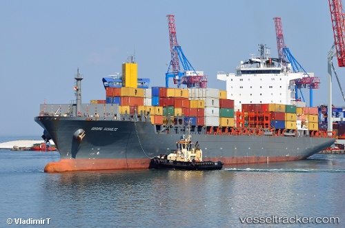
 CMA CGM AMBARLI
Current Status
Where is the vessel?
CMA CGM AMBARLI is currently in Near Tema, based on AIS data received less than 1h ago.
Latest AIS update:
Current position: 5.56464° N, 0.06735° E (Near Tema)
Average speed (last 7 days): Loading…
Average speed (last 30 days): Loading…
Vessel profile: CMA CGM AMBARLI is a Container Ship with dimensions m x m.
This page combines live AIS, route history, probable destination signals, nearby traffic, and port activity for practical vessel monitoring.
The current position of vessel CMA CGM AMBARLI is 5.56464 lat / 0.06735 lng. Updated: 2026-05-01 19:53:31 UTCNearest reference points:
- Near Ablogamé
- Near Sekondi
- Near Takoradi
Currently sailing under the flag of Malta ![]()
CMA CGM AMBARLI built in 2008 year
Deadweight:
42056 tDetails:
Live Vessel CMA CGM AMBARLI Analytics (details, animations, etc.)
Recent AIS points (UTC):
2026-05-01 16:05:33 UTC · 5.56466, 0.06719 · SOG 0.2 kn · COG 215°2026-05-01 18:23:37 UTC · 5.56469, 0.06724 · SOG 0.1 kn · COG 216°
2026-05-01 19:11:36 UTC · 5.56463, 0.06739 · SOG 0.1 kn · COG 220°
2026-05-01 19:53:31 UTC · 5.56464, 0.06735 · SOG 0 kn · COG 223°