 vesseltracker.com
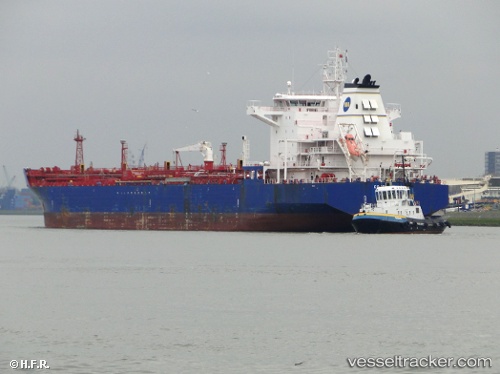
 Costanza M
Current Status
Where is the vessel?
Costanza M is currently in Near Algeciras, based on AIS data received less than 1h ago.
Latest AIS update:
Current position: 36.13675° N, 5.43068° W (Near Algeciras)
Average speed (last 7 days): Loading…
Average speed (last 30 days): Loading…
Vessel profile: Costanza M is a Chemical Oil Products Tanker with dimensions 182m x 32m.
This page combines live AIS, route history, probable destination signals, nearby traffic, and port activity for practical vessel monitoring.
The current position of vessel Costanza M is 36.13675 lat / -5.43068 lng. Updated: 2026-05-15 03:45:42 UTCNearest reference points:
- Near Algeciras
- Near Palmones
- Near Waterport
Currently sailing under the flag of Italy ![]()
Costanza M built in 2009 year
Deadweight:
40042 tDetails:
Live Vessel Costanza M Analytics (details, animations, etc.)
Recent AIS points (UTC):
2026-05-14 22:57:42 UTC · 36.13682, -5.43067 · SOG 0 kn · COG 3°2026-05-14 23:45:42 UTC · 36.13682, -5.43066 · SOG 0 kn · COG 3°
2026-05-15 01:12:42 UTC · 36.13679, -5.43067 · SOG 0 kn · COG 3°
2026-05-15 03:45:42 UTC · 36.13675, -5.43068 · SOG 0 kn · COG 3°