 vesseltracker.com
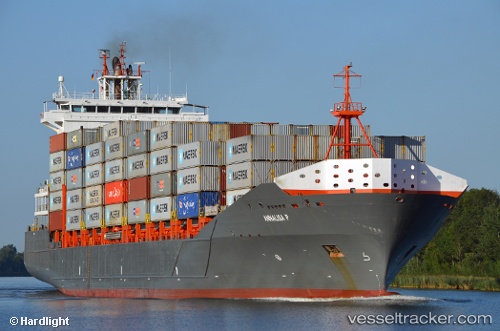
 Annalisa P
Current Status
Where is the vessel?
Annalisa P is currently in Near Bahrenfeld, based on AIS data received less than 1h ago.
Latest AIS update:
Current position: 53.53977° N, 9.91419° E (Near Bahrenfeld)
Average speed (last 7 days): Loading…
Average speed (last 30 days): Loading…
Vessel profile: Annalisa P is a Container Ship with dimensions 166m x 26m.
This page combines live AIS, route history, probable destination signals, nearby traffic, and port activity for practical vessel monitoring.
The current position of vessel Annalisa P is 53.53977 lat / 9.91419 lng. Updated: 2026-05-14 10:12:17 UTCNearest reference points:
- Near Bahrenfeld
- Near Hamburg-Mitte
- Near Allermöhe
Currently sailing under the flag of Antigua Barbuda ![]()
Annalisa P built in 2008 year
Deadweight:
18464 tDetails:
Live Vessel Annalisa P Analytics (details, animations, etc.)
Recent AIS points (UTC):
2026-05-14 05:45:07 UTC · 53.53979, 9.91418 · SOG 0 kn · COG 270°2026-05-14 07:57:11 UTC · 53.53966, 9.91419 · SOG 0 kn · COG 270°
2026-05-14 08:24:05 UTC · 53.53971, 9.91410 · SOG 0 kn · COG 270°
2026-05-14 10:12:17 UTC · 53.53977, 9.91419 · SOG 0 kn · COG 270°