 vesseltracker.com
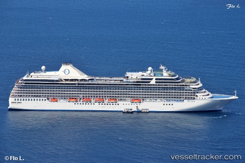
 Riviera
Current Status
Where is the vessel?
Riviera is currently in 69 nm N of Attu Island, based on AIS data received about 1h ago.
Latest AIS update:
Current position: 54.01667° N, 174.01833° E (69 nm N of Attu Island)
Average speed (last 7 days): Loading…
Average speed (last 30 days): Loading…
Vessel profile: Riviera is a Cruise Ship with dimensions 240m x 32m.
This page combines live AIS, route history, probable destination signals, nearby traffic, and port activity for practical vessel monitoring.
The current position of vessel Riviera is 54.01667 lat / 174.01833 lng. Updated: 2026-05-14 11:16:20 UTCNearest reference points:
- 57 nm SW of Zagorow
Currently sailing under the flag of Marshall Is ![]()
Riviera built in 2012 year
Deadweight:
7662 tDetails:
Live Vessel Riviera Analytics (details, animations, etc.)
Recent AIS points (UTC):
2026-05-14 07:36:18 UTC · 53.84171, 172.50488 · SOG 14.9 kn · COG 72°2026-05-14 09:57:48 UTC · 53.96230, 173.46638 · SOG 14.8 kn · COG 80°
2026-05-14 10:19:44 UTC · 53.98061, 173.61995 · SOG 15.2 kn · COG 79°
2026-05-14 11:16:20 UTC · 54.01667, 174.01833 · SOG 15 kn · COG -1°