 vesseltracker.com
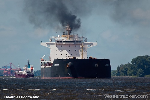
Andreas K
Current StatusWhere is the vessel?
Andreas K is currently in Near Gonglu, based on AIS data received less than 1h ago.
Latest AIS update:
Current position: 31.37545° N, 121.68720° E (Near Gonglu)
Average speed (last 7 days): Loading…
Average speed (last 30 days): Loading…
Vessel profile: Andreas K is a Bulk Carrier with dimensions 37m x 230m.
This page combines live AIS, route history, probable destination signals, nearby traffic, and port activity for practical vessel monitoring.
The current position of vessel Andreas K is 31.37545 lat / 121.68720 lng. Updated: 2026-05-14 16:54:12 UTCNearest reference points:
- Near Gonglu
- Near Wu-Sung
- Near Jinqiao
Details:
Live Vessel Andreas K Analytics (details, animations, etc.)
Recent AIS points (UTC):
2026-05-14 13:12:11 UTC · 31.37475, 121.68599 · SOG 0.2 kn · COG 119°2026-05-14 14:03:13 UTC · 31.37552, 121.68725 · SOG 0.1 kn · COG 119°
2026-05-14 15:48:12 UTC · 31.37542, 121.68686 · SOG 0 kn · COG 119°
2026-05-14 16:54:12 UTC · 31.37545, 121.68720 · SOG 0 kn · COG 119°