 vesseltracker.com
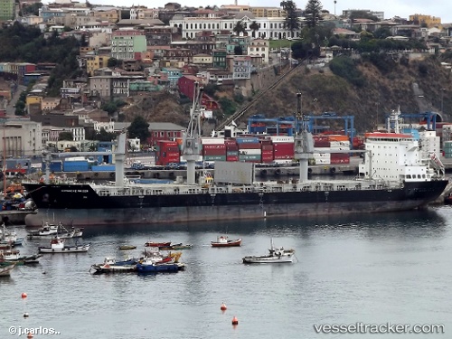
 DAFNI
DAFNI
Current Status
Where is the vessel?
DAFNI is currently in Near TSAWWASSEN, based on AIS data received less than 1h ago.
Latest AIS update:
Current position: 49.01500° N, 123.15500° W (Near TSAWWASSEN)
Average speed (last 7 days): Loading…
Average speed (last 30 days): Loading…
Vessel profile: DAFNI is a General Cargo Ship with dimensions 183m x 28m.
This page combines live AIS, route history, probable destination signals, nearby traffic, and port activity for practical vessel monitoring.
The current position of vessel DAFNI is 49.01500 lat / -123.15500 lng. Updated: 2026-05-15 23:31:47 UTCNearest reference points:
- Near STEVESTON
- Near Robert's Bank
- Near English Bay
Currently sailing under the flag of Marshall Islands ![]()
DAFNI built in 2011 year
Deadweight:
34037 tDetails:
Live Vessel DAFNI Analytics (details, animations, etc.)
Recent AIS points (UTC):
2026-05-15 20:06:51 UTC · 49.01511, -123.15557 · SOG 0 kn · COG 212°2026-05-15 21:27:53 UTC · 49.01512, -123.15557 · SOG 0 kn · COG 214°
2026-05-15 22:31:49 UTC · 49.01500, -123.15500 · SOG 0 kn · COG -1°
2026-05-15 23:31:47 UTC · 49.01500, -123.15500 · SOG 0 kn · COG -1°