 vesseltracker.com
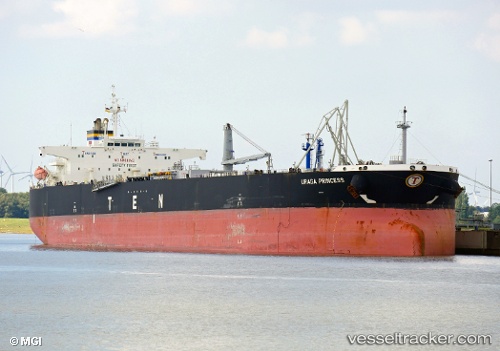
 URAGA PRINCESS
Current Status
Where is the vessel?
URAGA PRINCESS is currently in 34 nm NW of Dulang Marine Terminal, based on AIS data received about 10h ago.
Latest AIS update:
Current position: 6.08845° N, 103.67060° E (34 nm NW of Dulang Marine Terminal)
Average speed (last 7 days): Loading…
Average speed (last 30 days): Loading…
Vessel profile: URAGA PRINCESS is a Crude Oil Tanker with dimensions m x m.
This page combines live AIS, route history, probable destination signals, nearby traffic, and port activity for practical vessel monitoring.
The current position of vessel URAGA PRINCESS is 6.08845 lat / 103.67060 lng. Updated: 2026-04-29 00:36:53 UTCNearest reference points:
- 29 nm SW of Dulang Marine Terminal
- 46 nm N of Penara Marine Terminal
- Near Muda Marine Terminal
Details:
Live Vessel URAGA PRINCESS Analytics (details, animations, etc.)
Recent AIS points (UTC):
2026-04-29 00:36:53 UTC · 6.08845, 103.67060 · SOG 12.6 kn · COG 358°2026-04-29 00:36:53 UTC · 6.08845, 103.67060 · SOG 12.6 kn · COG 358°
2026-04-29 00:36:53 UTC · 6.08845, 103.67060 · SOG 12.6 kn · COG 358°
2026-04-29 00:36:53 UTC · 6.08845, 103.67060 · SOG 12.6 kn · COG 358°