 vesseltracker.com
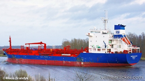
 PANCARANKHATULISTIWA
Current Status
Where is the vessel?
PANCARANKHATULISTIWA is currently in 11 nm E of Balikpapan, based on AIS data received about 1h ago.
Latest AIS update:
Current position: 1.30040° S, 116.99657° E (11 nm E of Balikpapan)
Average speed (last 7 days): Loading…
Average speed (last 30 days): Loading…
Vessel profile: PANCARANKHATULISTIWA is a Oil/Chemical Tanker with dimensions m x m.
This page combines live AIS, route history, probable destination signals, nearby traffic, and port activity for practical vessel monitoring.
The current position of vessel PANCARANKHATULISTIWA is -1.30040 lat / 116.99657 lng. Updated: 2026-05-15 06:13:33 UTCNearest reference points:
- 11 nm SE of Balikpapan
- Near Balikpapan
- Near KARIANGAU
Currently sailing under the flag of Indonesia ![]()
Details:
Live Vessel PANCARANKHATULISTIWA Analytics (details, animations, etc.)
Recent AIS points (UTC):
2026-05-14 23:43:35 UTC · -1.30087, 116.99683 · SOG 0 kn · COG 257°2026-05-15 04:19:32 UTC · -1.30053, 116.99665 · SOG 0 kn · COG 234°
2026-05-15 04:28:34 UTC · -1.30048, 116.99665 · SOG 0 kn · COG 232°
2026-05-15 06:13:33 UTC · -1.30040, 116.99657 · SOG 0 kn · COG 228°