 vesseltracker.com
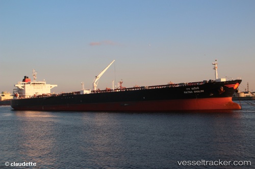
 Captain A.stellatos
Current Status
Where is the vessel?
Captain A.stellatos is currently in 33 nm SW of Okha, based on AIS data received about 1h ago.
Latest AIS update:
Current position: 22.22027° N, 68.56651° E (33 nm SW of Okha)
Average speed (last 7 days): Loading…
Average speed (last 30 days): Loading…
Vessel profile: Captain A.stellatos is a Crude Oil Tanker with dimensions 244m x 42m.
This page combines live AIS, route history, probable destination signals, nearby traffic, and port activity for practical vessel monitoring.
The current position of vessel Captain A.stellatos is 22.22027 lat / 68.56651 lng. Updated: 2026-05-17 08:07:22 UTCNearest reference points:
- 49 nm S of Positra
- 13 nm W of Måndvi
- 54 nm S of Positra
Currently sailing under the flag of Marshall Is ![]()
Captain A.stellatos built in 2010 year
Deadweight:
105849 tDetails:
Live Vessel Captain A.stellatos Analytics (details, animations, etc.)
Recent AIS points (UTC):
2026-05-17 04:25:43 UTC · 22.22206, 68.56650 · SOG 0 kn · COG 252°2026-05-17 06:07:42 UTC · 22.22129, 68.56665 · SOG 0.2 kn · COG 274°
2026-05-17 07:04:23 UTC · 22.22101, 68.56665 · SOG 0.3 kn · COG 282°
2026-05-17 08:07:22 UTC · 22.22027, 68.56651 · SOG 0.1 kn · COG 301°