 vesseltracker.com
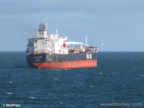
 Ridgebury Cindy A
Current Status
Where is the vessel?
Ridgebury Cindy A is currently in 67 nm W of Volcano, based on AIS data received less than 1h ago.
Latest AIS update:
Current position: 38.23445° N, 131.00822° W (67 nm W of Volcano)
Average speed (last 7 days): Loading…
Average speed (last 30 days): Loading…
Vessel profile: Ridgebury Cindy A is a Chemical Oil Products Tanker with dimensions 183m x 32m.
This page combines live AIS, route history, probable destination signals, nearby traffic, and port activity for practical vessel monitoring.
The current position of vessel Ridgebury Cindy A is 38.23445 lat / -131.00822 lng. Updated: 2026-05-14 07:29:23 UTCCurrently sailing under the flag of Marshall Is ![]()
Ridgebury Cindy A built in 2008 year
Deadweight:
50162 tDetails:
Live Vessel Ridgebury Cindy A Analytics (details, animations, etc.)
Recent AIS points (UTC):
2026-05-14 04:58:03 UTC · 38.33717, -130.32938 · SOG 12.9 kn · COG 261°2026-05-14 06:04:54 UTC · 38.29285, -130.63052 · SOG 13.2 kn · COG 263°
2026-05-14 07:15:33 UTC · 38.24353, -130.94682 · SOG 12.7 kn · COG 261°
2026-05-14 07:29:23 UTC · 38.23445, -131.00822 · SOG 12.5 kn · COG 262°