 vesseltracker.com
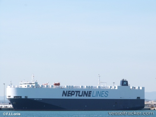
 Neptune Iliad
Current Status
Where is the vessel?
Neptune Iliad is currently in Near Ankaran, based on AIS data received less than 1h ago.
Latest AIS update:
Current position: 45.56485° N, 13.73870° E (Near Ankaran)
Average speed (last 7 days): Loading…
Average speed (last 30 days): Loading…
Vessel profile: Neptune Iliad is a Vehicles Carrier with dimensions 169m x 28m.
This page combines live AIS, route history, probable destination signals, nearby traffic, and port activity for practical vessel monitoring.
The current position of vessel Neptune Iliad is 45.56485 lat / 13.73870 lng. Updated: 2026-05-13 23:55:26 UTCNearest reference points:
- Near Ankaran
- Near Trieste
- Near IZOLA
Currently sailing under the flag of Malta ![]()
Neptune Iliad built in 2010 year
Deadweight:
11409 tDetails:
Live Vessel Neptune Iliad Analytics (details, animations, etc.)
Recent AIS points (UTC):
2026-05-13 19:55:24 UTC · 45.56485, 13.73869 · SOG 0 kn · COG 87°2026-05-13 21:52:26 UTC · 45.56486, 13.73873 · SOG 0 kn · COG 87°
2026-05-13 22:58:26 UTC · 45.56486, 13.73870 · SOG 0 kn · COG 87°
2026-05-13 23:55:26 UTC · 45.56485, 13.73870 · SOG 0 kn · COG 87°