 vesseltracker.com
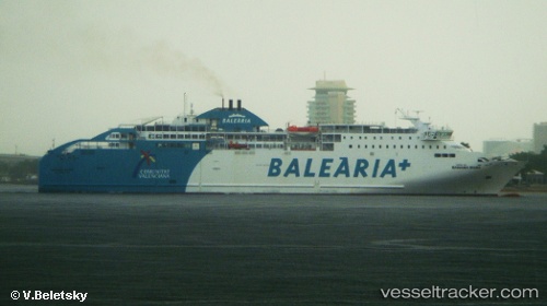
 BAHAMA MAMA
Current Status
Where is the vessel?
BAHAMA MAMA is currently in Near Sampedor, based on AIS data received about 1h ago.
Latest AIS update:
Current position: 40.81935° N, 2.05698° E (Near Sampedor)
Average speed (last 7 days): Loading…
Average speed (last 30 days): Loading…
Vessel profile: BAHAMA MAMA is a Ro-Ro/Passenger Ship with dimensions m x m.
This page combines live AIS, route history, probable destination signals, nearby traffic, and port activity for practical vessel monitoring.
The current position of vessel BAHAMA MAMA is 40.81935 lat / 2.05698 lng. Updated: 2026-05-16 15:34:07 UTCNearest reference points:
- Near LES BOTIGUES
- Near SITGES
- Near Barcelona
Details:
Live Vessel BAHAMA MAMA Analytics (details, animations, etc.)
Recent AIS points (UTC):
2026-05-16 12:19:46 UTC · 39.92500, 1.92167 · SOG 16 kn · COG -1°2026-05-16 13:55:45 UTC · 40.36333, 1.97167 · SOG 16 kn · COG -1°
2026-05-16 13:55:45 UTC · 40.36333, 1.97167 · SOG 16 kn · COG -1°
2026-05-16 15:34:07 UTC · 40.81935, 2.05698 · SOG 17.1 kn · COG 8°