 vesseltracker.com
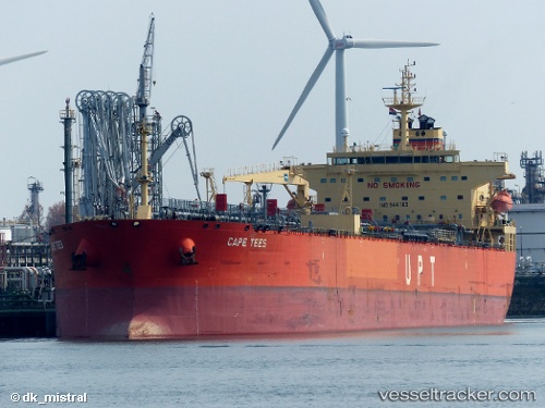
Cape Tees
Current StatusWhere is the vessel?
Cape Tees is currently in Near Barcelona, based on AIS data received about 1h ago.
Latest AIS update:
Current position: 10.21049° N, 64.76721° W (Near Barcelona)
Average speed (last 7 days): Loading…
Average speed (last 30 days): Loading…
Vessel profile: Cape Tees is a Crude Oil Tanker with dimensions 32m x 228m.
This page combines live AIS, route history, probable destination signals, nearby traffic, and port activity for practical vessel monitoring.
The current position of vessel Cape Tees is 10.21049 lat / -64.76721 lng. Updated: 2026-05-15 12:01:45 UTCNearest reference points:
- Near Puerto Sucre
- 15 nm SW of Punta de Piedras
Details:
Live Vessel Cape Tees Analytics (details, animations, etc.)
Recent AIS points (UTC):
2026-05-15 05:17:04 UTC · 11.22014, -65.13899 · SOG 11.7 kn · COG 140°2026-05-15 09:51:02 UTC · 10.34257, -64.82792 · SOG 12.5 kn · COG 157°
2026-05-15 10:21:10 UTC · 10.25221, -64.79225 · SOG 8.5 kn · COG 155°
2026-05-15 12:01:45 UTC · 10.21049, -64.76721 · SOG 0 kn · COG 192°