 vesseltracker.com
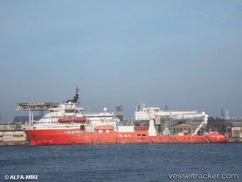
 Boka Da Vinci
Current Status
Where is the vessel?
Boka Da Vinci is currently in 18 nm NE of Hedenham, based on AIS data received less than 1h ago.
Latest AIS update:
Current position: 53.07841° N, 1.88680° E (18 nm NE of Hedenham)
Average speed (last 7 days): Loading…
Average speed (last 30 days): Loading…
Vessel profile: Boka Da Vinci is a Offshore Support Vessel with dimensions 116m x 22m.
This page combines live AIS, route history, probable destination signals, nearby traffic, and port activity for practical vessel monitoring.
The current position of vessel Boka Da Vinci is 53.07841 lat / 1.88680 lng. Updated: 2026-05-14 22:01:03 UTCNearest reference points:
- 11 nm NE of Caister on Sea
- Near Hemsby
- Near Hedenham
Currently sailing under the flag of Marshall Is ![]()
Boka Da Vinci built in 2011 year
Deadweight:
5640 tDetails:
Live Vessel Boka Da Vinci Analytics (details, animations, etc.)
Recent AIS points (UTC):
2026-05-14 17:25:44 UTC · 53.07838, 1.88674 · SOG 0 kn · COG 320°2026-05-14 19:45:24 UTC · 53.07840, 1.88679 · SOG 0 kn · COG 320°
2026-05-14 20:04:45 UTC · 53.07841, 1.88678 · SOG 0.1 kn · COG 320°
2026-05-14 22:01:03 UTC · 53.07841, 1.88680 · SOG 0 kn · COG 320°