 vesseltracker.com
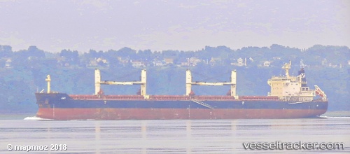
Jay
Current StatusWhere is the vessel?
Jay is currently in Near Vila do Conde Pt/Barcarena, based on AIS data received less than 1h ago.
Latest AIS update:
Current position: 1.49229° S, 48.78801° W (Near Vila do Conde Pt/Barcarena)
Average speed (last 7 days): Loading…
Average speed (last 30 days): Loading…
Vessel profile: Jay is a Bulk Carrier with dimensions 32m x 190m.
This page combines live AIS, route history, probable destination signals, nearby traffic, and port activity for practical vessel monitoring.
The current position of vessel Jay is -1.49229 lat / -48.78801 lng. Updated: 2026-05-14 02:52:23 UTCNearest reference points:
- Near Belem
- 55 nm N of Tucuma
- Near Santana
Details:
Live Vessel Jay Analytics (details, animations, etc.)
Recent AIS points (UTC):
2026-05-13 22:31:26 UTC · -1.49592, -48.78851 · SOG 0 kn · COG 23°2026-05-13 23:37:20 UTC · -1.49628, -48.79010 · SOG 0 kn · COG 52°
2026-05-14 02:01:23 UTC · -1.49591, -48.79005 · SOG 0.2 kn · COG 63°
2026-05-14 02:52:23 UTC · -1.49229, -48.78801 · SOG 0.1 kn · COG 192°