 vesseltracker.com
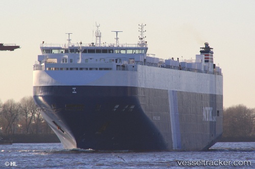
 Heritage Leader
Current Status
Where is the vessel?
Heritage Leader is currently in 103 nm E of Keaau, based on AIS data received less than 1h ago.
Latest AIS update:
Current position: 20.15918° N, 153.29797° W (103 nm E of Keaau)
Average speed (last 7 days): Loading…
Average speed (last 30 days): Loading…
Vessel profile: Heritage Leader is a Vehicles Carrier with dimensions 200m x 32m.
This page combines live AIS, route history, probable destination signals, nearby traffic, and port activity for practical vessel monitoring.
The current position of vessel Heritage Leader is 20.15918 lat / -153.29797 lng. Updated: 2026-05-15 07:46:27 UTCCurrently sailing under the flag of Bahamas ![]()
Heritage Leader built in 2011 year
Deadweight:
20434 tDetails:
Live Vessel Heritage Leader Analytics (details, animations, etc.)
Recent AIS points (UTC):
2026-05-15 03:43:26 UTC · 20.00062, -152.08597 · SOG 16.7 kn · COG 273°2026-05-15 04:18:57 UTC · 20.02500, -152.25833 · SOG 16 kn · COG -1°
2026-05-15 06:10:40 UTC · 20.10026, -152.81171 · SOG 16.8 kn · COG 277°
2026-05-15 07:46:27 UTC · 20.15918, -153.29797 · SOG 17.6 kn · COG 277°