 vesseltracker.com
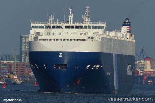
 Harmony Leader
Current Status
Where is the vessel?
Harmony Leader is currently in Near Duxbury, based on AIS data received about 1h ago.
Latest AIS update:
Current position: 42.06352° N, 70.48563° W (Near Duxbury)
Average speed (last 7 days): Loading…
Average speed (last 30 days): Loading…
Vessel profile: Harmony Leader is a Vehicles Carrier with dimensions 200m x 32m.
This page combines live AIS, route history, probable destination signals, nearby traffic, and port activity for practical vessel monitoring.
The current position of vessel Harmony Leader is 42.06352 lat / -70.48563 lng. Updated: 2026-05-14 02:25:27 UTCNearest reference points:
- Near Cohasset
- Near Barnstable
- Near South Yarmouth
Currently sailing under the flag of Bahamas ![]()
Harmony Leader built in 2011 year
Deadweight:
20434 tDetails:
Live Vessel Harmony Leader Analytics (details, animations, etc.)
Recent AIS points (UTC):
2026-05-13 23:01:50 UTC · 41.64815, -70.69156 · SOG 15.3 kn · COG 18°2026-05-14 00:22:39 UTC · 41.79585, -70.46578 · SOG 8.3 kn · COG 29°
2026-05-14 01:41:46 UTC · 41.96869, -70.46155 · SOG 7.7 kn · COG 350°
2026-05-14 02:25:27 UTC · 42.06352, -70.48563 · SOG 7.9 kn · COG 349°