 vesseltracker.com
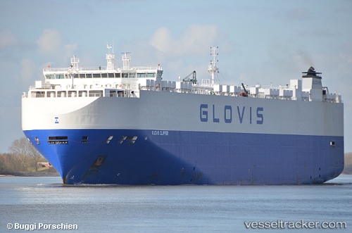
 Glovis Clipper
Current Status
Where is the vessel?
Glovis Clipper is currently in 124 nm S of António Enes, based on AIS data received about 1h ago.
Latest AIS update:
Current position: 18.18441° S, 39.24147° E (124 nm S of António Enes)
Average speed (last 7 days): Loading…
Average speed (last 30 days): Loading…
Vessel profile: Glovis Clipper is a Vehicles Carrier with dimensions 200m x 200m.
This page combines live AIS, route history, probable destination signals, nearby traffic, and port activity for practical vessel monitoring.
The current position of vessel Glovis Clipper is -18.18441 lat / 39.24147 lng. Updated: 2026-05-14 02:06:12 UTCNearest reference points:
- 95 nm E of Quelimane
- 229 nm SE of Quelimane
Currently sailing under the flag of Bahamas ![]()
Glovis Clipper built in 2012 year
Deadweight:
20434 tDetails:
Live Vessel Glovis Clipper Analytics (details, animations, etc.)
Recent AIS points (UTC):
2026-05-13 22:42:47 UTC · -17.43985, 39.66014 · SOG 15 kn · COG 204°2026-05-14 00:14:59 UTC · -17.77689, 39.47100 · SOG 14.6 kn · COG 203°
2026-05-14 01:33:36 UTC · -18.06479, 39.31308 · SOG 15 kn · COG 202°
2026-05-14 02:06:12 UTC · -18.18441, 39.24147 · SOG 15.2 kn · COG 201°