 vesseltracker.com
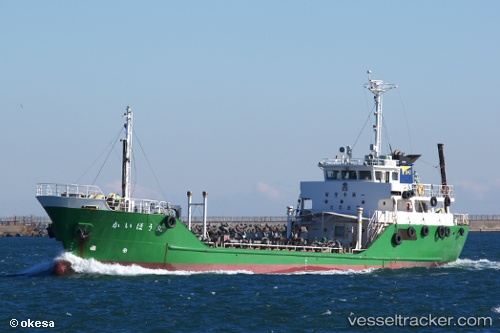
 Kaihou Maru
Current Status
Where is the vessel?
Kaihou Maru is currently in Near OKAMURA, based on AIS data received about 3h ago.
Latest AIS update:
Current position: 34.13994° N, 132.81694° E (Near OKAMURA)
Average speed (last 7 days): Loading…
Average speed (last 30 days): Loading…
Vessel profile: Kaihou Maru is a Lpg Tanker with dimensions 68m x 12m.
This page combines live AIS, route history, probable destination signals, nearby traffic, and port activity for practical vessel monitoring.
The current position of vessel Kaihou Maru is 34.13994 lat / 132.81694 lng. Updated: 2026-05-15 00:13:48 UTCNearest reference points:
- Near Yoshiumi
- Near TSUWAJI
- Near Kure
Currently sailing under the flag of Japan ![]()
Details:
Live Vessel Kaihou Maru Analytics (details, animations, etc.)
Recent AIS points (UTC):
2026-05-14 19:55:54 UTC · 34.37504, 133.79382 · SOG 15.1 kn · COG 254°2026-05-14 21:25:04 UTC · 34.25274, 133.39404 · SOG 13.3 kn · COG 252°
2026-05-14 22:23:14 UTC · 34.15200, 133.17741 · SOG 13.2 kn · COG 237°
2026-05-15 00:13:48 UTC · 34.13994, 132.81694 · SOG 12.8 kn · COG 260°