 vesseltracker.com
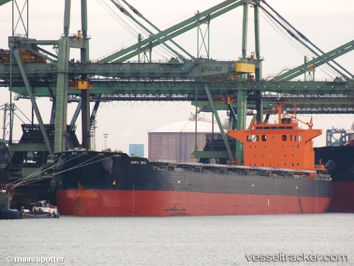
 SANTA CRUZ
Current Status
Where is the vessel?
SANTA CRUZ is currently in 49 nm NW of Torsvåg, based on AIS data received about 1h ago.
Latest AIS update:
Current position: 70.55273° N, 17.24983° E (49 nm NW of Torsvåg)
Average speed (last 7 days): Loading…
Average speed (last 30 days): Loading…
Vessel profile: SANTA CRUZ is a Bulk Carrier with dimensions m x m.
This page combines live AIS, route history, probable destination signals, nearby traffic, and port activity for practical vessel monitoring.
The current position of vessel SANTA CRUZ is 70.55273 lat / 17.24983 lng. Updated: 2026-05-14 20:03:59 UTCNearest reference points:
- Near SOMMAROY
- 52 nm NW of Ersfjord
- Near Skrolsvik
Currently sailing under the flag of Malta ![]()
Details:
Live Vessel SANTA CRUZ Analytics (details, animations, etc.)
Recent AIS points (UTC):
2026-05-14 16:18:40 UTC · 71.01602, 18.74544 · SOG 11 kn · COG 227°2026-05-14 17:22:58 UTC · 70.88000, 18.30900 · SOG 10.9 kn · COG 228°
2026-05-14 19:42:01 UTC · 70.59820, 17.39282 · SOG 10.5 kn · COG 229°
2026-05-14 20:03:59 UTC · 70.55273, 17.24983 · SOG 11.3 kn · COG 229°