 vesseltracker.com
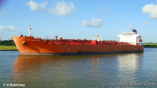
 TORM MALAYSIA
Current Status
Where is the vessel?
TORM MALAYSIA is currently in 60 nm NW of Pedernales, based on AIS data received less than 1h ago.
Latest AIS update:
Current position: 1.34133° N, 80.91318° W (60 nm NW of Pedernales)
Average speed (last 7 days): Loading…
Average speed (last 30 days): Loading…
Vessel profile: TORM MALAYSIA is a Chemical/Oil Products Tanker with dimensions 33m x 184m.
This page combines live AIS, route history, probable destination signals, nearby traffic, and port activity for practical vessel monitoring.
The current position of vessel TORM MALAYSIA is 1.34133 lat / -80.91318 lng. Updated: 2026-05-13 21:39:00 UTCNearest reference points:
- Near Esmeraldas
- 22 nm W of Bahía de Caráquez
- Near MANTA
Currently sailing under the flag of Denmark (DIS) ![]()
TORM MALAYSIA built in 2011 year
Deadweight:
49999 tDetails:
Live Vessel TORM MALAYSIA Analytics (details, animations, etc.)
Recent AIS points (UTC):
2026-05-13 17:56:42 UTC · 2.09500, -80.75167 · SOG 12 kn · COG -1°2026-05-13 19:45:42 UTC · 1.73040, -80.84505 · SOG 12.3 kn · COG 193°
2026-05-13 19:45:42 UTC · 1.73040, -80.84505 · SOG 12.3 kn · COG 193°
2026-05-13 21:39:00 UTC · 1.34133, -80.91318 · SOG 12.7 kn · COG 187°