 vesseltracker.com
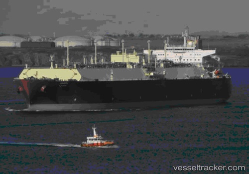
 Aamira
Current Status
Where is the vessel?
Aamira is currently in 17 nm W of Multi Services-SEZ/Dronagiri, based on AIS data received less than 1h ago.
Latest AIS update:
Current position: 19.17525° N, 72.53029° E (17 nm W of Multi Services-SEZ/Dronagiri)
Average speed (last 7 days): Loading…
Average speed (last 30 days): Loading…
Vessel profile: Aamira is a Lng Tanker with dimensions 345m x 345m.
This page combines live AIS, route history, probable destination signals, nearby traffic, and port activity for practical vessel monitoring.
The current position of vessel Aamira is 19.17525 lat / 72.53029 lng. Updated: 2026-05-15 23:23:32 UTCNearest reference points:
- Near HNB SEZ/Mumbai
- Near Mumbai
- Near NHAVA SHEVA
Currently sailing under the flag of Marshall Is ![]()
Aamira built in 2010 year
Deadweight:
130026 tDetails:
Live Vessel Aamira Analytics (details, animations, etc.)
Recent AIS points (UTC):
2026-05-15 20:23:52 UTC · 19.17526, 72.53007 · SOG 0 kn · COG 346°2026-05-15 20:23:52 UTC · 19.17526, 72.53007 · SOG 0 kn · COG 346°
2026-05-15 21:50:55 UTC · 19.17517, 72.52965 · SOG 0 kn · COG 352°
2026-05-15 23:23:32 UTC · 19.17525, 72.53029 · SOG 0 kn · COG 341°