 vesseltracker.com
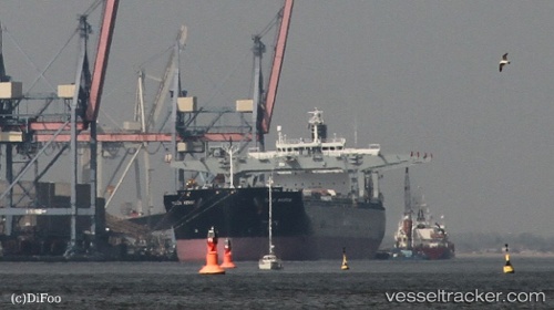
Tuju Arrow
Current StatusWhere is the vessel?
Tuju Arrow is currently in 13 nm NW of Taicang, based on AIS data received less than 1h ago.
Latest AIS update:
Current position: 31.77791° N, 121.00405° E (13 nm NW of Taicang)
Average speed (last 7 days): Loading…
Average speed (last 30 days): Loading…
Vessel profile: Tuju Arrow is a Bulk Carrier with dimensions 32m x 225m.
This page combines live AIS, route history, probable destination signals, nearby traffic, and port activity for practical vessel monitoring.
The current position of vessel Tuju Arrow is 31.77791 lat / 121.00405 lng. Updated: 2026-05-18 04:24:59 UTCNearest reference points:
- 10 nm NW of Taicang
- 13 nm NE of Changshu Pt
- 11 nm NW of Taicang
Details:
Live Vessel Tuju Arrow Analytics (details, animations, etc.)
Recent AIS points (UTC):
2026-05-18 01:38:51 UTC · 31.63563, 121.25758 · SOG 0 kn · COG 304°2026-05-18 01:41:49 UTC · 31.63561, 121.25759 · SOG 0 kn · COG 304°
2026-05-18 03:25:59 UTC · 31.69309, 121.16277 · SOG 9.8 kn · COG 302°
2026-05-18 04:24:59 UTC · 31.77791, 121.00405 · SOG 7.7 kn · COG 275°