 vesseltracker.com
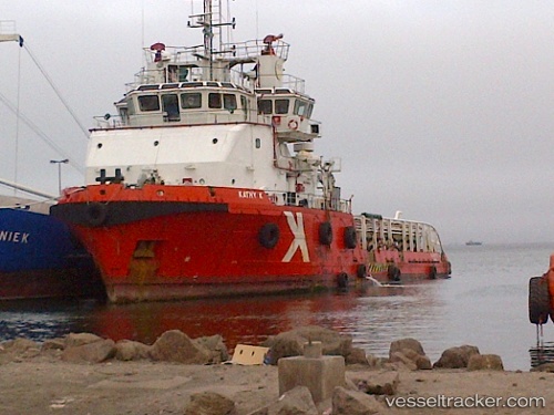
Kathy K
Current StatusWhere is the vessel?
Kathy K is currently in Near Mina Khalid, based on AIS data received about 23d ago.
Latest AIS update:
Current position: 25.36251° N, 55.37497° E (Near Mina Khalid)
Average speed (last 7 days): Loading…
Average speed (last 30 days): Loading…
Vessel profile: Kathy K is a Offshore Tug Supply Ship with dimensions 16m x 60m.
This page combines live AIS, route history, probable destination signals, nearby traffic, and port activity for practical vessel monitoring.
The current position of vessel Kathy K is 25.36251 lat / 55.37497 lng. Updated: 2026-04-22 01:32:05 UTCNearest reference points:
- Near Mina Khalid
- Near Sharjah
- Near Mina Rashid Port
Details:
Live Vessel Kathy K Analytics (details, animations, etc.)
Recent AIS points (UTC):
2026-04-22 01:32:05 UTC · 25.36251, 55.37497 · SOG 0 kn · COG -1°