 vesseltracker.com
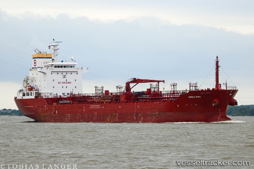
 Songa Ruby
Current Status
Where is the vessel?
Songa Ruby is currently in 16 nm NW of De Panne, based on AIS data received less than 1h ago.
Latest AIS update:
Current position: 51.34402° N, 2.41088° E (16 nm NW of De Panne)
Average speed (last 7 days): Loading…
Average speed (last 30 days): Loading…
Vessel profile: Songa Ruby is a Chemical Oil Products Tanker with dimensions 144m x 22m.
This page combines live AIS, route history, probable destination signals, nearby traffic, and port activity for practical vessel monitoring.
The current position of vessel Songa Ruby is 51.34402 lat / 2.41088 lng. Updated: 2026-05-15 03:59:10 UTCNearest reference points:
- 13 nm NW of Middelkerke
- Near Dunkerque
- Near Lombardsijde
Currently sailing under the flag of Malta ![]()
Songa Ruby built in 2008 year
Deadweight:
17604 tDetails:
Live Vessel Songa Ruby Analytics (details, animations, etc.)
Recent AIS points (UTC):
2026-05-14 22:37:20 UTC · 50.65516, 1.27411 · SOG 11.7 kn · COG 50°2026-05-14 23:58:50 UTC · 50.88998, 1.48116 · SOG 12.4 kn · COG 15°
2026-05-15 01:15:50 UTC · 51.08853, 1.74497 · SOG 11.8 kn · COG 52°
2026-05-15 03:59:10 UTC · 51.34402, 2.41088 · SOG 9.7 kn · COG 69°