 vesseltracker.com
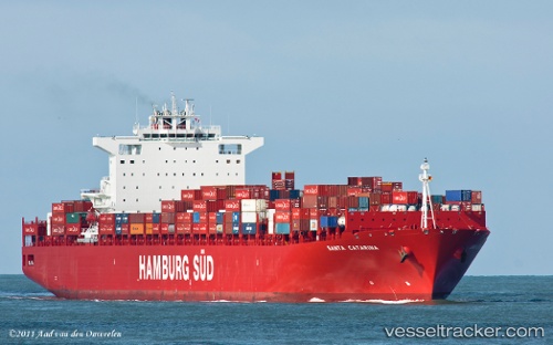
 Santa Catarina
Current Status
Where is the vessel?
Santa Catarina is currently in 41 nm E of SHIDAO, based on AIS data received less than 1h ago.
Latest AIS update:
Current position: 36.77442° N, 123.30657° E (41 nm E of SHIDAO)
Average speed (last 7 days): Loading…
Average speed (last 30 days): Loading…
Vessel profile: Santa Catarina is a Container Ship with dimensions 300m x 42m.
This page combines live AIS, route history, probable destination signals, nearby traffic, and port activity for practical vessel monitoring.
The current position of vessel Santa Catarina is 36.77442 lat / 123.30657 lng. Updated: 2026-05-02 15:21:32 UTCNearest reference points:
- 32 nm E of SHIDAO
- 53 nm E of SHIDAO
- 43 nm SE of Longyan Pt
Currently sailing under the flag of Denmark ![]()
Santa Catarina built in 2011 year
Deadweight:
93591 tDetails:
Live Vessel Santa Catarina Analytics (details, animations, etc.)
Recent AIS points (UTC):
2026-05-02 12:01:11 UTC · 37.53795, 123.32446 · SOG 12.5 kn · COG 169°2026-05-02 13:58:50 UTC · 37.10140, 123.31726 · SOG 14 kn · COG 184°
2026-05-02 14:00:27 UTC · 37.09512, 123.31673 · SOG 14 kn · COG 184°
2026-05-02 15:21:32 UTC · 36.77442, 123.30657 · SOG 14.1 kn · COG 179°