 vesseltracker.com
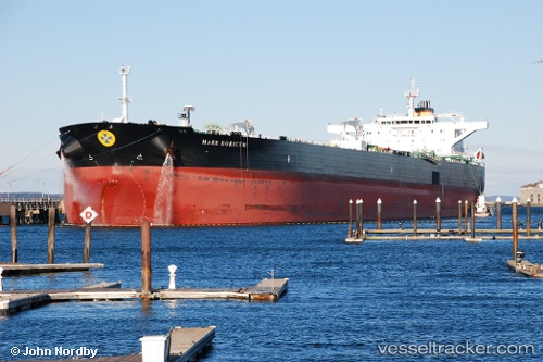
Mare Doricum
Current StatusWhere is the vessel?
Mare Doricum is currently in 42 nm S of Saint-Philippe, based on AIS data received about 100d ago.
Latest AIS update:
Current position: 22.05159° S, 55.95071° E (42 nm S of Saint-Philippe)
Average speed (last 7 days): Loading…
Average speed (last 30 days): Loading…
Vessel profile: Mare Doricum is a Crude Oil Tanker with dimensions 48m x 274m.
This page combines live AIS, route history, probable destination signals, nearby traffic, and port activity for practical vessel monitoring.
The current position of vessel Mare Doricum is -22.05159 lat / 55.95071 lng. Updated: 2026-01-21 04:04:32 UTCNearest reference points:
- 129 nm W of Al Azaiba
- 61 nm NW of Al Azaiba
- Near Port Louis
Details:
Live Vessel Mare Doricum Analytics (details, animations, etc.)
Recent AIS points (UTC):
2026-01-21 04:04:32 UTC · -22.05159, 55.95071 · SOG 2.7 kn · COG 225°