 vesseltracker.com
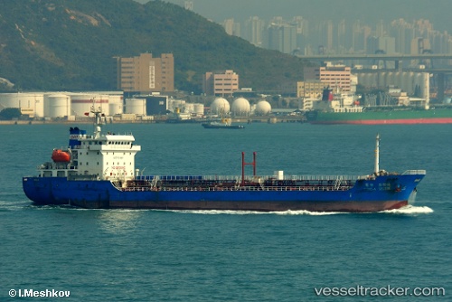
Lady Elizabeth
Current StatusWhere is the vessel?
Lady Elizabeth is currently in 228 nm S of Tarpon Springs, based on AIS data received about 21d ago.
Latest AIS update:
Current position: 24.99891° N, 28.08478° W (228 nm S of Tarpon Springs)
Average speed (last 7 days): Loading…
Average speed (last 30 days): Loading…
Vessel profile: Lady Elizabeth is a Oil Products Tanker with dimensions 16m x 111m.
This page combines live AIS, route history, probable destination signals, nearby traffic, and port activity for practical vessel monitoring.
The current position of vessel Lady Elizabeth is 24.99891 lat / -28.08478 lng. Updated: 2026-04-24 15:08:40 UTCNearest reference points:
- 289 nm S of Tarpon Springs
Details:
Live Vessel Lady Elizabeth Analytics (details, animations, etc.)
Recent AIS points (UTC):
2026-04-24 15:08:40 UTC · 24.99891, -28.08478 · SOG 6.2 kn · COG 129°