 vesseltracker.com
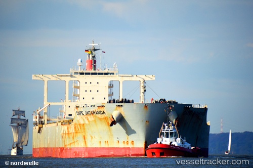
 Cape Jacaranda
Current Status
Where is the vessel?
Cape Jacaranda is currently in 13 nm E of Cape Agulhas, based on AIS data received about 1h ago.
Latest AIS update:
Current position: 34.87600° S, 20.26760° E (13 nm E of Cape Agulhas)
Average speed (last 7 days): Loading…
Average speed (last 30 days): Loading…
Vessel profile: Cape Jacaranda is a Bulk Carrier with dimensions 292m x 45m.
This page combines live AIS, route history, probable destination signals, nearby traffic, and port activity for practical vessel monitoring.
The current position of vessel Cape Jacaranda is -34.87600 lat / 20.26760 lng. Updated: 2026-05-16 07:30:56 UTCNearest reference points:
- 15 nm SE of Moorreesburg
- 37 nm S of Mosselbaai
- Near Mitchells Plain
Currently sailing under the flag of Panama ![]()
Details:
Live Vessel Cape Jacaranda Analytics (details, animations, etc.)
Recent AIS points (UTC):
2026-05-16 03:24:56 UTC · -34.91840, 19.47392 · SOG 9.5 kn · COG 103°2026-05-16 04:01:41 UTC · -34.93307, 19.59149 · SOG 9.6 kn · COG 90°
2026-05-16 05:32:14 UTC · -34.95806, 19.89038 · SOG 9.8 kn · COG 99°
2026-05-16 07:30:56 UTC · -34.87600, 20.26760 · SOG 10.1 kn · COG 57°