 vesseltracker.com
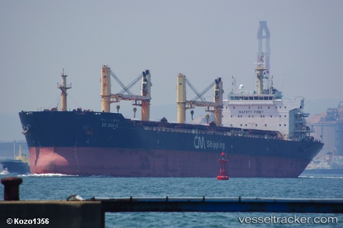
 MALAK
MALAK
Current Status
Where is the vessel?
MALAK is currently in Near Chittagong, based on AIS data received about 94d ago.
Latest AIS update:
Current position: 22.22851° N, 91.76031° E (Near Chittagong)
Average speed (last 7 days): Loading…
Average speed (last 30 days): Loading…
Vessel profile: MALAK is a Bulk Carrier with dimensions 190m x 32m.
This page combines live AIS, route history, probable destination signals, nearby traffic, and port activity for practical vessel monitoring.
The current position of vessel MALAK is 22.22851 lat / 91.76031 lng. Updated: 2026-01-21 09:25:30 UTCNearest reference points:
- Near Chittagong
- 12 nm NW of Chattogram
- 23 nm NW of Cox's Bazar
Currently sailing under the flag of Barbados ![]()
MALAK built in 2010 year
Deadweight:
56942 tDetails:
Live Vessel MALAK Analytics (details, animations, etc.)
Recent AIS points (UTC):
2026-01-21 09:25:30 UTC · 22.22851, 91.76031 · SOG 0.5 kn · COG 326°