 vesseltracker.com
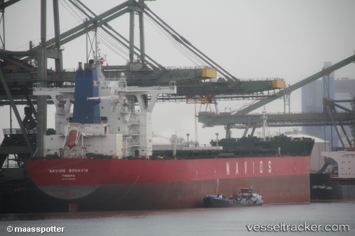
Navios Bonavis
Current StatusWhere is the vessel?
Navios Bonavis is currently in 180 nm NW of Palau, based on AIS data received less than 1h ago.
Latest AIS update:
Current position: 11.73363° N, 136.04266° E (180 nm NW of Palau)
Average speed (last 7 days): Loading…
Average speed (last 30 days): Loading…
Vessel profile: Navios Bonavis is a Bulk Carrier with dimensions 45m x 292m.
This page combines live AIS, route history, probable destination signals, nearby traffic, and port activity for practical vessel monitoring.
The current position of vessel Navios Bonavis is 11.73363 lat / 136.04266 lng. Updated: 2026-05-01 05:44:20 UTCNearest reference points:
- 150 nm N of Palau
- 77 nm NW of Palau
- 207 nm N of Palau
Details:
Live Vessel Navios Bonavis Analytics (details, animations, etc.)
Recent AIS points (UTC):
2026-05-01 01:46:58 UTC · 12.36358, 135.65601 · SOG 11.5 kn · COG 148°2026-05-01 02:48:27 UTC · 12.19538, 135.75453 · SOG 10.9 kn · COG 148°
2026-05-01 04:34:38 UTC · 11.91513, 135.92308 · SOG 11.1 kn · COG 145°
2026-05-01 05:44:20 UTC · 11.73363, 136.04266 · SOG 10.9 kn · COG 140°