 vesseltracker.com
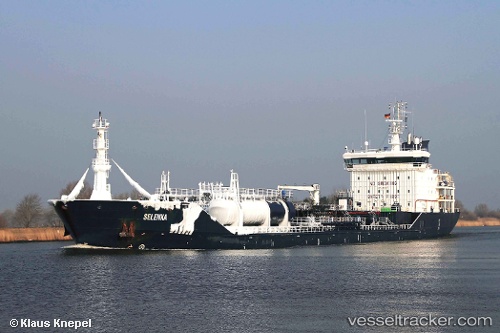
 Selenka
Current Status
Where is the vessel?
Selenka is currently in 197 nm S of Ben Slimane, based on AIS data received about 2h ago.
Latest AIS update:
Current position: 30.43361° N, 72.20338° W (197 nm S of Ben Slimane)
Average speed (last 7 days): Loading…
Average speed (last 30 days): Loading…
Vessel profile: Selenka is a Chemical Oil Products Tanker with dimensions 132m x 19m.
This page combines live AIS, route history, probable destination signals, nearby traffic, and port activity for practical vessel monitoring.
The current position of vessel Selenka is 30.43361 lat / -72.20338 lng. Updated: 2026-05-14 19:24:20 UTCNearest reference points:
- 150 nm S of Ben Slimane
Currently sailing under the flag of Malta ![]()
Selenka built in 2009 year
Deadweight:
10745 tDetails:
Live Vessel Selenka Analytics (details, animations, etc.)
Recent AIS points (UTC):
2026-05-14 12:03:00 UTC · 31.10267, -70.85633 · SOG 10.4 kn · COG 98°2026-05-14 12:03:00 UTC · 31.10267, -70.85633 · SOG 10.4 kn · COG 98°
2026-05-14 19:24:20 UTC · 30.43361, -72.20338 · SOG 11.3 kn · COG 241°
2026-05-14 19:24:20 UTC · 30.43361, -72.20338 · SOG 11.3 kn · COG 241°