 vesseltracker.com
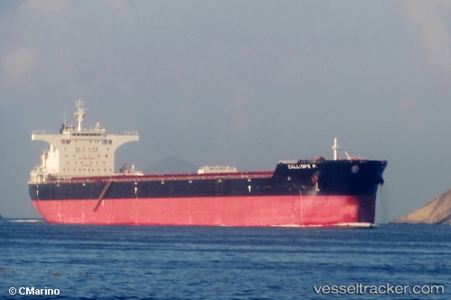
 CALLIOPE P.
Current Status
Where is the vessel?
CALLIOPE P. is currently in 58 nm E of SHIDAO, based on AIS data received less than 1h ago.
Latest AIS update:
Current position: 36.77526° N, 123.66774° E (58 nm E of SHIDAO)
Average speed (last 7 days): Loading…
Average speed (last 30 days): Loading…
Vessel profile: CALLIOPE P. is a Bulk Carrier with dimensions 291m x 291m.
This page combines live AIS, route history, probable destination signals, nearby traffic, and port activity for practical vessel monitoring.
The current position of vessel CALLIOPE P. is 36.77526 lat / 123.66774 lng. Updated: 2026-05-14 11:59:42 UTCNearest reference points:
- 53 nm E of SHIDAO
- 56 nm SE of SHIDAO
- 59 nm SE of SHIDAO
Currently sailing under the flag of Marshall Islands ![]()
CALLIOPE P. built in 2011 year
Deadweight:
175153 tDetails:
Live Vessel CALLIOPE P. Analytics (details, animations, etc.)
Recent AIS points (UTC):
2026-05-14 07:51:26 UTC · 36.05400, 123.82646 · SOG 10.7 kn · COG 351°2026-05-14 10:27:25 UTC · 36.50853, 123.73228 · SOG 10.6 kn · COG 353°
2026-05-14 11:01:41 UTC · 36.60942, 123.70850 · SOG 10.5 kn · COG 348°
2026-05-14 11:59:42 UTC · 36.77526, 123.66774 · SOG 10.3 kn · COG 343°