 vesseltracker.com
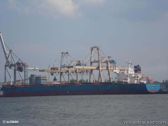
 BIRTE OLDENDORFF
Current Status
Where is the vessel?
BIRTE OLDENDORFF is currently in 266 nm W of Tinaquillo, based on AIS data received about 1h ago.
Latest AIS update:
Current position: 8.89833° N, 63.92833° E (266 nm W of Tinaquillo)
Average speed (last 7 days): Loading…
Average speed (last 30 days): Loading…
Vessel profile: BIRTE OLDENDORFF is a Bulk Carrier with dimensions 250m x 43m.
This page combines live AIS, route history, probable destination signals, nearby traffic, and port activity for practical vessel monitoring.
The current position of vessel BIRTE OLDENDORFF is 8.89833 lat / 63.92833 lng. Updated: 2026-05-14 00:06:10 UTCNearest reference points:
- Open sea, approx. 400 nm off the nearest listed port
- Open sea, approx. 402 nm off the nearest listed port
- Open sea, approx. 401 nm off the nearest listed port
Currently sailing under the flag of Liberia ![]()
BIRTE OLDENDORFF built in 2010 year
Deadweight:
114167 tDetails:
Live Vessel BIRTE OLDENDORFF Analytics (details, animations, etc.)
Recent AIS points (UTC):
2026-05-13 19:57:04 UTC · 8.39167, 63.49167 · SOG 9 kn · COG -1°2026-05-13 21:27:06 UTC · 8.57833, 63.64833 · SOG 9 kn · COG -1°
2026-05-13 22:15:06 UTC · 8.67333, 63.73500 · SOG 9 kn · COG -1°
2026-05-14 00:06:10 UTC · 8.89833, 63.92833 · SOG 9 kn · COG -1°