 vesseltracker.com
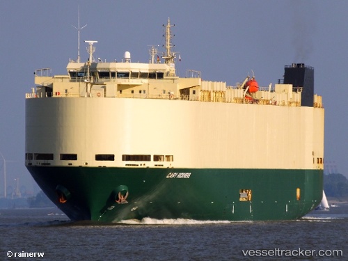
 SILVER SKY
Current Status
Where is the vessel?
SILVER SKY is currently in Near Rivergate, based on AIS data received about 2h ago.
Latest AIS update:
Current position: 45.64655° N, 122.75622° W (Near Rivergate)
Average speed (last 7 days): Loading…
Average speed (last 30 days): Loading…
Vessel profile: SILVER SKY is a Vehicles Carrier with dimensions 183m x 32m.
This page combines live AIS, route history, probable destination signals, nearby traffic, and port activity for practical vessel monitoring.
The current position of vessel SILVER SKY is 45.64655 lat / -122.75622 lng. Updated: 2026-05-02 20:02:01 UTCNearest reference points:
- Near Linnton
- Near LONGVIEW
- Near Astoria
Currently sailing under the flag of Panama ![]()
SILVER SKY built in 2010 year
Deadweight:
12300 tDetails:
Live Vessel SILVER SKY Analytics (details, animations, etc.)
Recent AIS points (UTC):
2026-05-02 16:20:03 UTC · 45.64653, -122.75620 · SOG 0 kn · COG 136°2026-05-02 18:08:37 UTC · 45.64650, -122.75600 · SOG 0 kn · COG 136°
2026-05-02 19:41:03 UTC · 45.64653, -122.75618 · SOG 0 kn · COG 136°
2026-05-02 20:02:01 UTC · 45.64655, -122.75622 · SOG 0 kn · COG 136°