 vesseltracker.com
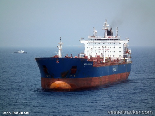
 PETITE SOEUR
Current Status
Where is the vessel?
PETITE SOEUR is currently in 39 nm S of Barongarook, based on AIS data received less than 1h ago.
Latest AIS update:
Current position: 39.04397° S, 143.77258° E (39 nm S of Barongarook)
Average speed (last 7 days): Loading…
Average speed (last 30 days): Loading…
Vessel profile: PETITE SOEUR is a Chemical Oil Products Tanker with dimensions 183m x 32m.
This page combines live AIS, route history, probable destination signals, nearby traffic, and port activity for practical vessel monitoring.
The current position of vessel PETITE SOEUR is -39.04397 lat / 143.77258 lng. Updated: 2026-05-13 23:31:02 UTCNearest reference points:
- Near Geelong North
- Near QUEENSCLIFF
- Near Drysdale
Currently sailing under the flag of Marshall Islands ![]()
PETITE SOEUR built in 2011 year
Deadweight:
50420 tDetails:
Live Vessel PETITE SOEUR Analytics (details, animations, etc.)
Recent AIS points (UTC):
2026-05-13 20:03:51 UTC · -38.98305, 142.91553 · SOG 12.8 kn · COG 106°2026-05-13 22:09:12 UTC · -39.09861, 143.45638 · SOG 12.5 kn · COG 106°
2026-05-13 22:19:32 UTC · -39.10822, 143.50101 · SOG 12.6 kn · COG 106°
2026-05-13 23:31:02 UTC · -39.04397, 143.77258 · SOG 12.2 kn · COG 51°