 vesseltracker.com
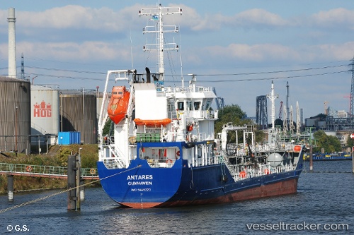
 ANTARES
Current Status
Where is the vessel?
ANTARES is currently in Near Thurso, based on AIS data received about 1h ago.
Latest AIS update:
Current position: 58.61115° N, 3.54738° W (Near Thurso)
Average speed (last 7 days): Loading…
Average speed (last 30 days): Loading…
Vessel profile: ANTARES is a Oil/Chemical Tanker with dimensions m x m.
This page combines live AIS, route history, probable destination signals, nearby traffic, and port activity for practical vessel monitoring.
The current position of vessel ANTARES is 58.61115 lat / -3.54738 lng. Updated: 2026-04-25 22:06:13 UTCNearest reference points:
- Near STROMNESS
- Near Staxigoe
- Near Tingwall
Currently sailing under the flag of Portugal ![]()
Details:
Live Vessel ANTARES Analytics (details, animations, etc.)
Recent AIS points (UTC):
2026-04-25 19:44:40 UTC · 58.61114, -3.54738 · SOG 0 kn · COG 312°2026-04-25 19:53:38 UTC · 58.61115, -3.54738 · SOG 0 kn · COG 311°
2026-04-25 21:20:40 UTC · 58.61117, -3.54740 · SOG 0 kn · COG 312°
2026-04-25 22:06:13 UTC · 58.61115, -3.54738 · SOG 0 kn · COG 310°