 vesseltracker.com
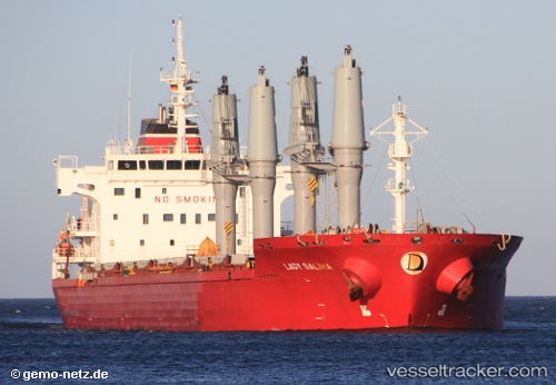
Lady Saliha
Current StatusWhere is the vessel?
Lady Saliha is currently in Near Nantong, based on AIS data received less than 1h ago.
Latest AIS update:
Current position: 31.99627° N, 120.82949° E (Near Nantong)
Average speed (last 7 days): Loading…
Average speed (last 30 days): Loading…
Vessel profile: Lady Saliha is a Bulk Carrier with dimensions 28m x 178m.
This page combines live AIS, route history, probable destination signals, nearby traffic, and port activity for practical vessel monitoring.
The current position of vessel Lady Saliha is 31.99627 lat / 120.82949 lng. Updated: 2026-05-14 11:57:44 UTCNearest reference points:
- Near Nantong
- Near Nantong Pt
- 10 nm SW of Nantong
Details:
Live Vessel Lady Saliha Analytics (details, animations, etc.)
Recent AIS points (UTC):
2026-05-14 07:50:59 UTC · 31.99623, 120.82951 · SOG 0.1 kn · COG 315°2026-05-14 10:24:42 UTC · 31.99635, 120.82934 · SOG 0.1 kn · COG 316°
2026-05-14 11:00:42 UTC · 31.99628, 120.82952 · SOG 0.2 kn · COG 316°
2026-05-14 11:57:44 UTC · 31.99627, 120.82949 · SOG 0.1 kn · COG 316°