 vesseltracker.com
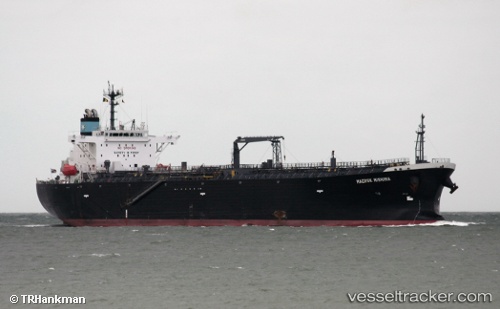
Atalanta T
Current StatusWhere is the vessel?
Atalanta T is currently in Near SUNOCO LOGISTICS, based on AIS data received less than 1h ago.
Latest AIS update:
Current position: 30.01074° N, 93.98909° W (Near SUNOCO LOGISTICS)
Average speed (last 7 days): Loading…
Average speed (last 30 days): Loading…
Vessel profile: Atalanta T is a Oil Products Tanker with dimensions 32m x 180m.
This page combines live AIS, route history, probable destination signals, nearby traffic, and port activity for practical vessel monitoring.
The current position of vessel Atalanta T is 30.01074 lat / -93.98909 lng. Updated: 2026-05-16 11:25:48 UTCNearest reference points:
- Near SUNOCO LOGISTICS
- Near Dowling
- Near Atreco
Details:
Live Vessel Atalanta T Analytics (details, animations, etc.)
Recent AIS points (UTC):
2026-05-16 08:08:31 UTC · 30.07667, -94.07833 · SOG 0 kn · COG -1°2026-05-16 10:21:48 UTC · 30.06674, -94.04752 · SOG 5.3 kn · COG 130°
2026-05-16 11:01:08 UTC · 30.02112, -94.02536 · SOG 5.7 kn · COG 120°
2026-05-16 11:25:48 UTC · 30.01074, -93.98909 · SOG 4.5 kn · COG 108°